
GIS Data Is There. Most of Your Organization Cannot Reach It.
Spatial data drives nearly every city and county operation. Getting to it without a GIS specialist is another matter.
01
GIS data only specialists know how to find
02
No way to ask spatial questions without writing queries
03
Data lineage rebuilt manually on every project
04
Spatial data siloed from every other enterprise system
05
AI workflows blocked by data no one can access
06
GIS team capacity spent on discovery, not development

Amorphic Spatial Intelligence
One Intelligence Layer. Four Capabilities.
Amorphic Spatial Intelligence is a single intelligence layer that sits on top of your existing GIS environment. GIS teams keep their platform. Every other department gains the ability to find, understand, and query the spatial data it holds.

Find any spatial dataset using plain language

See complete data lineage automatically

Query spatial data without writing SQL

Combine GIS with other enterprise data
No Systems Replaced. No Data Moved.
From Data Sitting Still to Intelligence in Motion
Four capabilities that work in sequence — connect the data, find it, understand it, query it.
GIS Connector and Ingestion
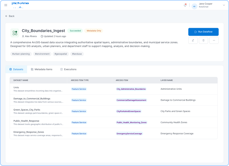
Automatically index your GIS environment without disruption. Amorphic connects to your GIS platform via standard APIs, ingesting datasets, metadata, and item relationships. SQL Server geodatabases are also supported.
- Feature Layers, Feature Services, Dashboards, Hub Pages, and Hub Site Applications ingested automatically
- SQL Server and other spatial sources supported
- All spatial data indexed alongside other enterprise data in one catalog
Natural Language Search
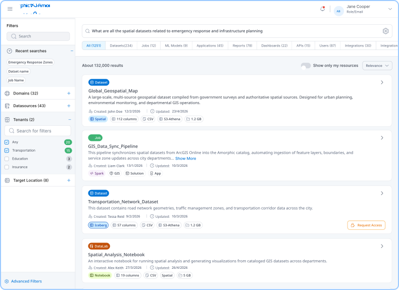
Find any spatial dataset by describing what you need. Staff type a plain-language question and receive relevant datasets with metadata and an embedded map preview. No exact dataset name required.
- Similarity search surfaces related datasets even when terminology differs
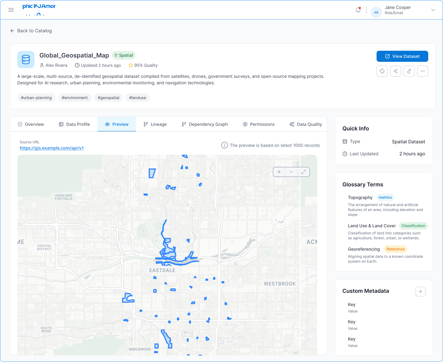
- Embedded map preview shows spatial data directly in the platform
- Click any map point to see its underlying data inline
- Direct link back to the originating source item
Automated Data Lineage
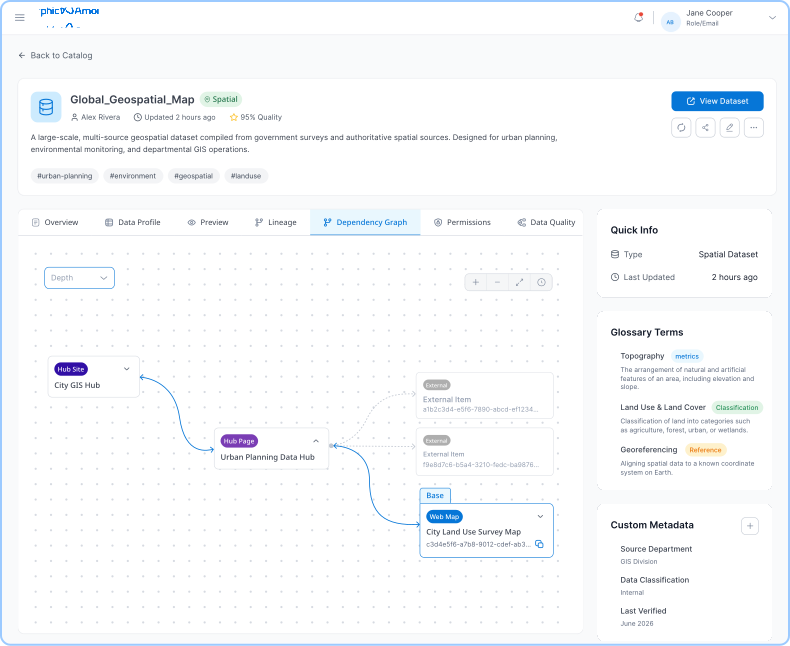
See where every piece of spatial data comes from, including what you haven’t ingested yet. Amorphic maps the full item hierarchy on ingestion: Feature Layers through Feature Services, Dashboards, Hub Pages, and Hub Site Applications. Items not yet ingested appear as grayed-out nodes, giving teams full ecosystem visibility from the start.
- Visual dependency graph for every GIS-sourced dataset
- Grayed-out nodes show non-ingested items — full picture without full ingestion
- Embedded source links for direct navigation to originating items
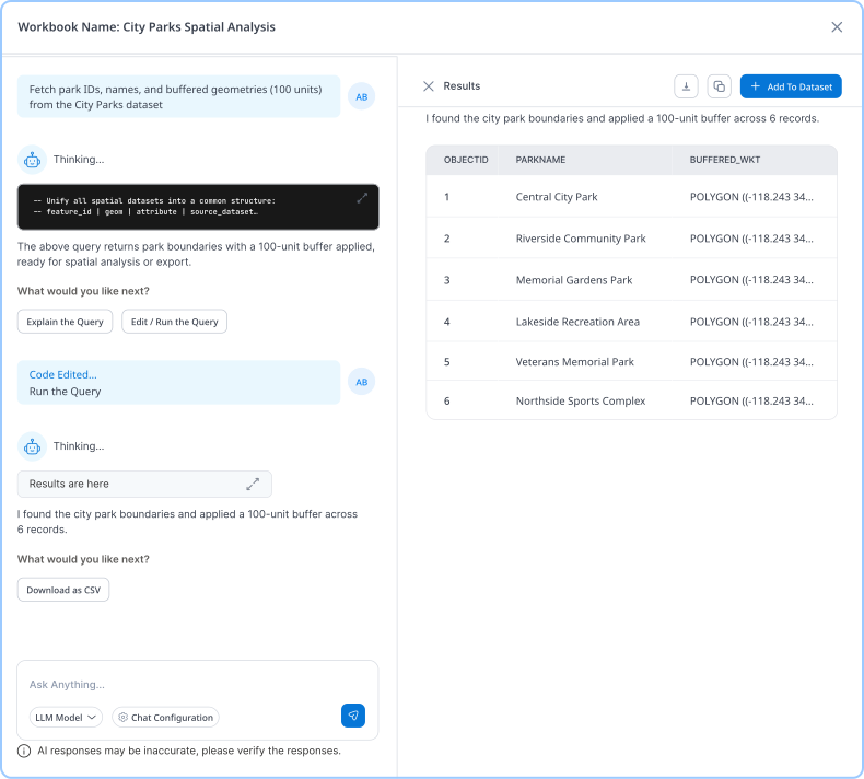
Spatial SQL AI
Ask geographic questions. Get answers, no SQL required. Analysts type the question they actually have and the system builds and executes the spatial query automatically. Results are viewable in the platform, saveable as new datasets, or routable to PowerBI or QuickSight.
- Natural language spatial queries against any cataloged dataset
- ST_Within, ST_Buffer, ST_Contains, and other spatial SQL functions via Athena
- Results exportable to BI tools or saveable as new datasets
Built for Every Department That Depends on Spatial Data

GIS and Data Teams
One searchable catalog for all spatial data so specialists spend time building, not fielding discovery requests.

Fire, EMS, and Emergency Management
Query incident coverage, resource locations, and response area gaps in plain language, in minutes.

Public Health
Map incident clusters, query EMS call density by zone, and track geographic trends without specialist involvement.

Planning and Permitting
Combine GIS data with permit records and run spatial queries to understand land use, infrastructure, and development patterns.

Public Works and Utilities
Connect spatial infrastructure records with work order systems and query the combined data to identify gaps and prioritize maintenance.

Law Enforcement
Surface crime density patterns and query incident data by geographic area without routing every request through an analyst.

Citizen Services and Public Portal Development
Process and analyze spatial data internally, then use those outputs to power resident-facing portals for permits, service requests, and public infrastructure.
What Your Organization Gains

Spatial Data Every Team Can Use
Any staff member can find, preview, and query spatial data independently — no specialist required.

Developer Productivity on Every GIS Project
Automated lineage replaces manual dependency investigation. Developers see the full source chain the moment they open a dataset.

Spatial Analysis Without the Bottleneck
Departments get answers directly. GIS team time shifts from responding to requests to building with data.

GIS as the Foundation for Broader Unification
Organizations that deploy Amorphic for GIS consistently expand it to connect police, fire, HR, and permitting data alongside it.

Faster Development of GIS-Powered Applications
One environment where ArcGIS data, lineage, and enterprise sources are all connected. No manual dependency discovery. Shorter development cycles.

No Replacement. No Disruption.
Amorphic connects via API and keeps every existing system in place. The GIS investment is extended, not retired.
Government-Grade Security and Control
Customer-controlled AWS deployment with human oversight in every decision.

Customer-Controlled AWS Deployment

Secure Authentication and SSO

Full Audit Trails

Encryption at Rest and in Transit

Human Oversight in Every Decision

